LOG IN & JOIN QMC FOR SPECIAL DEALS & PRICES!
Fishing Hot Spots

At Fishing Hot Spots, we’re dedicated to making detailed, high-quality fishing maps and chips for navigation units. The challenge that drives us is the same one that motivates you: We want to figure out how to catch bigger fish, more often, while saving time and energy.
To most of the fishing world, solving this problem means designing new and better gear. The result is a mind-boggling variety of options for your tackle box, each one touted by its maker as the best new way to catch fish. But we see this challenge differently. Maybe buying those new baits can help you catch more fish, but if you’re fishing in the wrong spots, at the wrong depth, during the wrong time of year, you’ll have likely wasted both your time and money.
We know catching fish is about more than just having the right tools. Though proper tackle is important, the best way to catch fish is by staying in the know. Think of the anglers you’ve known who wouldn’t give the location of their favorite spot to their best friend. They know that once you experience how good the fishing is there, you’ll be back again and again. Knowing your lake well—knowing the most productive baits and techniques, knowing where the best Hot Spots are—that’s what helps you catch fish. And because every waterbody is its own unique environment , these answers are going to change depending on where you fish.
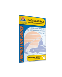
That’s why we go to the most in-the-know experts—guides, lake biologists, bait shop owners, tournament pros—to ensure that the information that shows up on our maps is as accurate and useful as possible. Our Deluxe View maps include specific fishing spots, public boat ramps, vegetation, hazards, bottom composition, and more. Paired with our precision digital cartography, our maps and navigation chips help you get on fish fast, and stay on them all year round.
Fishing Hot Spots started in 1975 when we created our first book of lake maps. To give anglers the best advantage possible, the maps featured helpful advice on how and where to fish on each lake. Before long, we transitioned to the rugged, water-proof maps that we are known for today. Larger and more detailed, these maps featured more and better information, and they soon became the cornerstone of our business. Over time, the maps evolved, first, gaining precision through state-of-the-art, digital cartography. In the 1990’s our fishing maps were united with the world of GPS navigation. Using chartplotters, anglers could now navigate directly to the trusted fishing areas from our printed maps. Partnering with manufactures like Lowrance, C-Map, Raymarine, and Garmin, made our expert information available to millions of anglers. The rise of the internet fueled further innovation. In 2010, a fishing-based social network, called Fishidy was founded, making the expert information from our maps available to anyone with an internet connection. Our current collection of where-to-fish information includes more than 600 print-edition maps spanning 41 states and digital products featuring over 150,000 points of interest.
In February of 2022, an agreement was reached with East View Map Link to promote and manage the printed map business. East View Map Link is America's largest wholesale map distributor for resellers with access to unique publishers from around the world. Our experienced staff understands the needs of resellers and takes the lead in recommending map selections and other map-related products for your store or website, along with a suite of value-added services such as warehousing, fulfillment, and drop shipping. Map Link also manages the direct-to-consumer brands of Omnimap, Longitude Maps, and Lakemaps for recreational fishing, hiking, biking, travel, and wall art enthusiasts.
$24.99 - $29.99
Our Price: $24.99 Retail Price: $24.99 Our Price: $21.99 Save as much as $3.00 (12%)


